Important notices
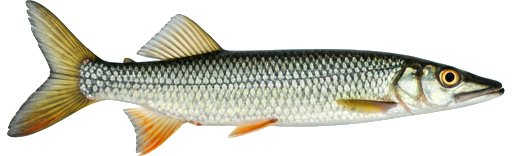
Main Southwest Miramichi River, Miramichi — Fishing restrictions
| Season / Restrictions | Bag Limit | Minimum Size | Maximum Size |
|---|---|---|---|
| May 1 – September 15 Rivers, brooks and streams ⚠ | 5 | 15cm | N/A |
| Exceptions | |||
| January 1 – December 31 Fly Fishing in rivers, brooks and streams upstream from a line drawn at the mouth of Doyles Brook from grid reference 751539 5194066 to grid reference 751553 5193718, Northumberland County , to the junction of the North Branch Southwest Miramichi River and South Branch Southwest Miramichi River, Carleton County | Fly fishing only | ||
| July 1 – December 31 Rivers, brooks and streams at the mouth of Wilson Brook and including a portion of the said brook. This specific area consists of a portion of the Southwest Miramichi River inside a line drawn from (1) 46.89432, -65.64613; to (2) 46.89418, -65.64423; then to (3) 46.89340, -65.64325 to (4) 46.89209, -65.64532; and then to (5) 46.89286, -65.64632 (North American Datum 1983) | Closed to angling after June 30 | ||
| July 1 – December 31 Rivers, brooks and streams at the mouth of Indiantown Brook and including a portion of the said brook next to Quarryville Bridge. This specific area consists of a portion of the Southwest Miramichi River inside a line drawn from (1) 46.82941, -65.79013; to (2) 46.83065, -65.78412; then to (3) 46.82943, -65.78277 to (4) 46.82597, -65.78799; and then to (5) 46.82631, -65.79003 (North American Datum 1983) | Closed to angling after June 30 | ||
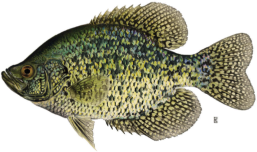
| Season / Restrictions | Bag Limit | Minimum Size | Maximum Size |
|---|---|---|---|
| May 16 – September 15 Fly Fishing in rivers, brooks and streams tributaries downstream of Cains River ⚠ | 0 ⚠ 2 | N/A | N/A |
| May 16 – October 15 Fly Fishing in rivers, brooks and streams ⚠ | 0 ⚠ 2 | N/A | N/A |
| May 16 – October 15 Fly Fishing in rivers, brooks and streams tributaries upstream of Cains River ⚠ | 0 ⚠ 2 | N/A | N/A |
| Exceptions | |||
| January 1 – December 31 Fly Fishing in rivers, brooks and streams upstream from a line drawn at the mouth of Doyles Brook from grid reference 751539 5194066 to grid reference 751553 5193718, Northumberland County , to the junction of the North Branch Southwest Miramichi River and South Branch Southwest Miramichi River, Carleton County | Fly fishing only | ||
| July 1 – December 31 Rivers, brooks and streams at the mouth of Wilson Brook and including a portion of the said brook. This specific area consists of a portion of the Southwest Miramichi River inside a line drawn from (1) 46.89432, -65.64613; to (2) 46.89418, -65.64423; then to (3) 46.89340, -65.64325 to (4) 46.89209, -65.64532; and then to (5) 46.89286, -65.64632 (North American Datum 1983) | Closed to angling after June 30 | ||
| July 1 – December 31 Rivers, brooks and streams at the mouth of Indiantown Brook and including a portion of the said brook next to Quarryville Bridge. This specific area consists of a portion of the Southwest Miramichi River inside a line drawn from (1) 46.82941, -65.79013; to (2) 46.83065, -65.78412; then to (3) 46.82943, -65.78277 to (4) 46.82597, -65.78799; and then to (5) 46.82631, -65.79003 (North American Datum 1983) | Closed to angling after June 30 | ||
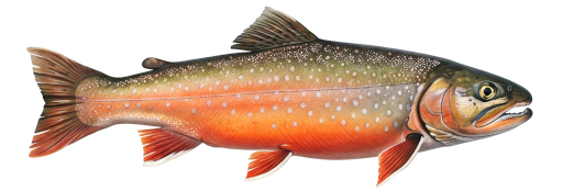
| Season / Restrictions | Bag Limit | Minimum Size | Maximum Size |
|---|---|---|---|
| May 1 – September 15 Rivers, brooks and streams ⚠ | 5 | 10cm | N/A |
| Exceptions | |||
| January 1 – December 31 Fly Fishing in rivers, brooks and streams upstream from a line drawn at the mouth of Doyles Brook from grid reference 751539 5194066 to grid reference 751553 5193718, Northumberland County , to the junction of the North Branch Southwest Miramichi River and South Branch Southwest Miramichi River, Carleton County | Fly fishing only | ||
| July 1 – December 31 Rivers, brooks and streams at the mouth of Wilson Brook and including a portion of the said brook. This specific area consists of a portion of the Southwest Miramichi River inside a line drawn from (1) 46.89432, -65.64613; to (2) 46.89418, -65.64423; then to (3) 46.89340, -65.64325 to (4) 46.89209, -65.64532; and then to (5) 46.89286, -65.64632 (North American Datum 1983) | Closed to angling after June 30 | ||
| July 1 – December 31 Rivers, brooks and streams at the mouth of Indiantown Brook and including a portion of the said brook next to Quarryville Bridge. This specific area consists of a portion of the Southwest Miramichi River inside a line drawn from (1) 46.82941, -65.79013; to (2) 46.83065, -65.78412; then to (3) 46.82943, -65.78277 to (4) 46.82597, -65.78799; and then to (5) 46.82631, -65.79003 (North American Datum 1983) | Closed to angling after June 30 | ||
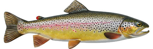
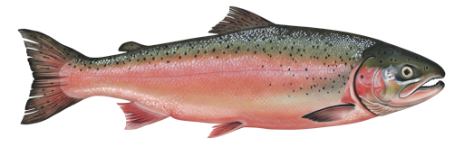
| Season / Restrictions | Bag Limit | Minimum Size | Maximum Size |
|---|---|---|---|
| May 1 – September 15 Rivers, brooks and streams ⚠ | 5 | 15cm | N/A |
| Exceptions | |||
| January 1 – December 31 Fly Fishing in rivers, brooks and streams upstream from a line drawn at the mouth of Doyles Brook from grid reference 751539 5194066 to grid reference 751553 5193718, Northumberland County , to the junction of the North Branch Southwest Miramichi River and South Branch Southwest Miramichi River, Carleton County | Fly fishing only | ||
| July 1 – December 31 Rivers, brooks and streams at the mouth of Wilson Brook and including a portion of the said brook. This specific area consists of a portion of the Southwest Miramichi River inside a line drawn from (1) 46.89432, -65.64613; to (2) 46.89418, -65.64423; then to (3) 46.89340, -65.64325 to (4) 46.89209, -65.64532; and then to (5) 46.89286, -65.64632 (North American Datum 1983) | Closed to angling after June 30 | ||
| July 1 – December 31 Rivers, brooks and streams at the mouth of Indiantown Brook and including a portion of the said brook next to Quarryville Bridge. This specific area consists of a portion of the Southwest Miramichi River inside a line drawn from (1) 46.82941, -65.79013; to (2) 46.83065, -65.78412; then to (3) 46.82943, -65.78277 to (4) 46.82597, -65.78799; and then to (5) 46.82631, -65.79003 (North American Datum 1983) | Closed to angling after June 30 | ||
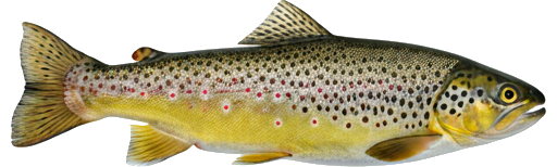
| Season / Restrictions | Bag Limit | Minimum Size | Maximum Size |
|---|---|---|---|
| January 1 – December 31 Non-tidal waters | 10 | 10cm | 100cm |
| January 1 – December 30 Tidal waters | 10 | 10cm | 100cm |
| Exceptions | |||
| January 1 – December 31 Fly Fishing in rivers, brooks and streams upstream from a line drawn at the mouth of Doyles Brook from grid reference 751539 5194066 to grid reference 751553 5193718, Northumberland County , to the junction of the North Branch Southwest Miramichi River and South Branch Southwest Miramichi River, Carleton County | Fly fishing only | ||
| July 1 – December 31 Rivers, brooks and streams at the mouth of Wilson Brook and including a portion of the said brook. This specific area consists of a portion of the Southwest Miramichi River inside a line drawn from (1) 46.89432, -65.64613; to (2) 46.89418, -65.64423; then to (3) 46.89340, -65.64325 to (4) 46.89209, -65.64532; and then to (5) 46.89286, -65.64632 (North American Datum 1983) | Closed to angling after June 30 | ||
| July 1 – December 31 Rivers, brooks and streams at the mouth of Indiantown Brook and including a portion of the said brook next to Quarryville Bridge. This specific area consists of a portion of the Southwest Miramichi River inside a line drawn from (1) 46.82941, -65.79013; to (2) 46.83065, -65.78412; then to (3) 46.82943, -65.78277 to (4) 46.82597, -65.78799; and then to (5) 46.82631, -65.79003 (North American Datum 1983) | Closed to angling after June 30 | ||
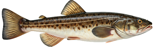
| Season / Restrictions | Bag Limit | Minimum Size | Maximum Size |
|---|---|---|---|
| May 1 – September 15 Rivers, brooks and streams ⚠ | 5 | 15cm | N/A |
| Exceptions | |||
| January 1 – December 31 Fly Fishing in rivers, brooks and streams upstream from a line drawn at the mouth of Doyles Brook from grid reference 751539 5194066 to grid reference 751553 5193718, Northumberland County , to the junction of the North Branch Southwest Miramichi River and South Branch Southwest Miramichi River, Carleton County | Fly fishing only | ||
| July 1 – December 31 Rivers, brooks and streams at the mouth of Wilson Brook and including a portion of the said brook. This specific area consists of a portion of the Southwest Miramichi River inside a line drawn from (1) 46.89432, -65.64613; to (2) 46.89418, -65.64423; then to (3) 46.89340, -65.64325 to (4) 46.89209, -65.64532; and then to (5) 46.89286, -65.64632 (North American Datum 1983) | Closed to angling after June 30 | ||
| July 1 – December 31 Rivers, brooks and streams at the mouth of Indiantown Brook and including a portion of the said brook next to Quarryville Bridge. This specific area consists of a portion of the Southwest Miramichi River inside a line drawn from (1) 46.82941, -65.79013; to (2) 46.83065, -65.78412; then to (3) 46.82943, -65.78277 to (4) 46.82597, -65.78799; and then to (5) 46.82631, -65.79003 (North American Datum 1983) | Closed to angling after June 30 | ||
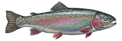
| Season / Restrictions | Bag Limit | Minimum Size | Maximum Size |
|---|---|---|---|
| January 1 – December 31 Non-tidal waters | 5 | N/A | N/A |
| January 1 – December 31 Tidal waters | 5 | N/A | N/A |
| Exceptions | |||
| January 1 – December 31 Fly Fishing in rivers, brooks and streams upstream from a line drawn at the mouth of Doyles Brook from grid reference 751539 5194066 to grid reference 751553 5193718, Northumberland County , to the junction of the North Branch Southwest Miramichi River and South Branch Southwest Miramichi River, Carleton County | Fly fishing only | ||
| July 1 – December 31 Rivers, brooks and streams at the mouth of Wilson Brook and including a portion of the said brook. This specific area consists of a portion of the Southwest Miramichi River inside a line drawn from (1) 46.89432, -65.64613; to (2) 46.89418, -65.64423; then to (3) 46.89340, -65.64325 to (4) 46.89209, -65.64532; and then to (5) 46.89286, -65.64632 (North American Datum 1983) | Closed to angling after June 30 | ||
| July 1 – December 31 Rivers, brooks and streams at the mouth of Indiantown Brook and including a portion of the said brook next to Quarryville Bridge. This specific area consists of a portion of the Southwest Miramichi River inside a line drawn from (1) 46.82941, -65.79013; to (2) 46.83065, -65.78412; then to (3) 46.82943, -65.78277 to (4) 46.82597, -65.78799; and then to (5) 46.82631, -65.79003 (North American Datum 1983) | Closed to angling after June 30 | ||
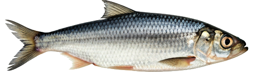
| Season / Restrictions | Bag Limit | Minimum Size | Maximum Size |
|---|---|---|---|
| April 15 – May 15 Fly Fishing in rivers, brooks and streams tributaries downstream of Cains River ⚠ | 0 ⚠ 5 | N/A | N/A |
| April 15 – May 15 Fly Fishing in rivers, brooks and streams ⚠ | 0 ⚠ 5 | N/A | N/A |
| April 15 – May 15 Fly Fishing in rivers, brooks and streams tributaries upstream of Cains River ⚠ | 0 ⚠ 5 | N/A | N/A |
| Exceptions | |||
| January 1 – December 31 Fly Fishing in rivers, brooks and streams upstream from a line drawn at the mouth of Doyles Brook from grid reference 751539 5194066 to grid reference 751553 5193718, Northumberland County , to the junction of the North Branch Southwest Miramichi River and South Branch Southwest Miramichi River, Carleton County | Fly fishing only | ||
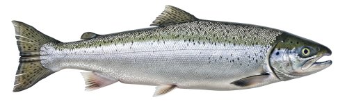
| Season / Restrictions | Bag Limit | Minimum Size | Maximum Size |
|---|---|---|---|
| January 1 – December 31 Non-tidal waters | 25 | 10cm | 50cm |
| January 1 – December 30 Tidal waters | 25 | 10cm | 50cm |
| Exceptions | |||
| January 1 – December 31 Fly Fishing in rivers, brooks and streams upstream from a line drawn at the mouth of Doyles Brook from grid reference 751539 5194066 to grid reference 751553 5193718, Northumberland County , to the junction of the North Branch Southwest Miramichi River and South Branch Southwest Miramichi River, Carleton County | Fly fishing only | ||
| July 1 – December 31 Rivers, brooks and streams at the mouth of Wilson Brook and including a portion of the said brook. This specific area consists of a portion of the Southwest Miramichi River inside a line drawn from (1) 46.89432, -65.64613; to (2) 46.89418, -65.64423; then to (3) 46.89340, -65.64325 to (4) 46.89209, -65.64532; and then to (5) 46.89286, -65.64632 (North American Datum 1983) | Closed to angling after June 30 | ||
| July 1 – December 31 Rivers, brooks and streams at the mouth of Indiantown Brook and including a portion of the said brook next to Quarryville Bridge. This specific area consists of a portion of the Southwest Miramichi River inside a line drawn from (1) 46.82941, -65.79013; to (2) 46.83065, -65.78412; then to (3) 46.82943, -65.78277 to (4) 46.82597, -65.78799; and then to (5) 46.82631, -65.79003 (North American Datum 1983) | Closed to angling after June 30 | ||
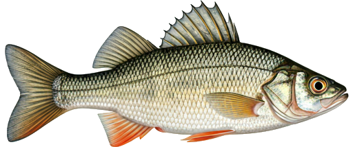
| Season / Restrictions | Bag Limit | Minimum Size | Maximum Size |
|---|---|---|---|
| January 1 – September 15 Non-tidal waters | 8 | 10cm | 70cm |
| January 1 – September 15 Tidal waters | 8 | 10cm | 70cm |
| Exceptions | |||
| January 1 – December 31 Fly Fishing in rivers, brooks and streams upstream from a line drawn at the mouth of Doyles Brook from grid reference 751539 5194066 to grid reference 751553 5193718, Northumberland County , to the junction of the North Branch Southwest Miramichi River and South Branch Southwest Miramichi River, Carleton County | Fly fishing only | ||
| July 1 – December 31 Rivers, brooks and streams at the mouth of Wilson Brook and including a portion of the said brook. This specific area consists of a portion of the Southwest Miramichi River inside a line drawn from (1) 46.89432, -65.64613; to (2) 46.89418, -65.64423; then to (3) 46.89340, -65.64325 to (4) 46.89209, -65.64532; and then to (5) 46.89286, -65.64632 (North American Datum 1983) | Closed to angling after June 30 | ||
| July 1 – December 31 Rivers, brooks and streams at the mouth of Indiantown Brook and including a portion of the said brook next to Quarryville Bridge. This specific area consists of a portion of the Southwest Miramichi River inside a line drawn from (1) 46.82941, -65.79013; to (2) 46.83065, -65.78412; then to (3) 46.82943, -65.78277 to (4) 46.82597, -65.78799; and then to (5) 46.82631, -65.79003 (North American Datum 1983) | Closed to angling after June 30 | ||
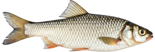
| Season / Restrictions | Bag Limit | Minimum Size | Maximum Size |
|---|---|---|---|
| January 1 – December 31 Non-tidal waters | 100 | 10cm | 50cm |
| January 1 – December 30 Tidal waters | 100 | 10cm | 50cm |
| Exceptions | |||
| January 1 – December 31 Fly Fishing in rivers, brooks and streams upstream from a line drawn at the mouth of Doyles Brook from grid reference 751539 5194066 to grid reference 751553 5193718, Northumberland County , to the junction of the North Branch Southwest Miramichi River and South Branch Southwest Miramichi River, Carleton County | Fly fishing only | ||
| July 1 – December 31 Rivers, brooks and streams at the mouth of Wilson Brook and including a portion of the said brook. This specific area consists of a portion of the Southwest Miramichi River inside a line drawn from (1) 46.89432, -65.64613; to (2) 46.89418, -65.64423; then to (3) 46.89340, -65.64325 to (4) 46.89209, -65.64532; and then to (5) 46.89286, -65.64632 (North American Datum 1983) | Closed to angling after June 30 | ||
| July 1 – December 31 Rivers, brooks and streams at the mouth of Indiantown Brook and including a portion of the said brook next to Quarryville Bridge. This specific area consists of a portion of the Southwest Miramichi River inside a line drawn from (1) 46.82941, -65.79013; to (2) 46.83065, -65.78412; then to (3) 46.82943, -65.78277 to (4) 46.82597, -65.78799; and then to (5) 46.82631, -65.79003 (North American Datum 1983) | Closed to angling after June 30 | ||