Important notices
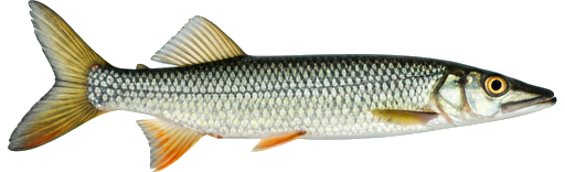
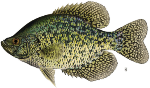
Northwest Miramichi River, Miramichi — Fishing restrictions
| Season / Restrictions | Bag Limit | Minimum Size | Maximum Size |
|---|---|---|---|
| May 1 – September 15 Rivers, brooks and streams ⚠ | 5 | 15cm | N/A |
| Exceptions | |||
| January 1 – December 31 Rivers, brooks and streams within 100 m of the Route 430 bridge, locally known as Miners Bridge | Closed to angling | ||
| January 1 – December 31 Fly Fishing in rivers, brooks and streams from a point 200 m above the South Branch of the Northwest Miramichi River, downstream to the Red Bank/Sunny Corner highway bridge | Fly fishing only | ||
| January 1 – December 31 Rivers, brooks and streams from a point 200 m above the South Branch of the Northwest Miramichi River upstream to its source, including all tributaries | Closed to angling | ||
| July 1 – December 31 Rivers, brooks and streams at the mouth of Sutherland Brook and including a portion of the said brook. This specific area consists of a portion of the Northwest Miramichi River inside a line drawn from (1) 46.94136, -65.81815 to (2) 46.94003, -65.81606; then to (3) 46.93857, -65.81808 to (4) 46.93850, -65.82057; to (5) 46.93867, -65.82082; and then to (6) 46.93979, -65.82049 (North American Datum 1983) | Closed after June 30 | ||
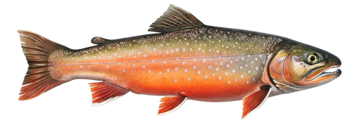
| Season / Restrictions | Bag Limit | Minimum Size | Maximum Size |
|---|---|---|---|
| May 16 – October 15 , | 0 ⚠ 2 | N/A | N/A |
| June 10 – September 15 | 0 ⚠ 2 | N/A | N/A |
| Fly Fishing in rivers, brooks and streams ⚠ | |||
| Exceptions | |||
| January 1 – December 31 Rivers, brooks and streams within 100 m of the Route 430 bridge, locally known as Miners Bridge | Closed to angling | ||
| January 1 – December 31 Fly Fishing in rivers, brooks and streams from a point 200 m above the South Branch of the Northwest Miramichi River, downstream to the Red Bank/Sunny Corner highway bridge | Fly fishing only | ||
| January 1 – December 31 Rivers, brooks and streams from a point 200 m above the South Branch of the Northwest Miramichi River upstream to its source, including all tributaries | Closed to angling | ||
| July 1 – December 31 Rivers, brooks and streams at the mouth of Sutherland Brook and including a portion of the said brook. This specific area consists of a portion of the Northwest Miramichi River inside a line drawn from (1) 46.94136, -65.81815 to (2) 46.94003, -65.81606; then to (3) 46.93857, -65.81808 to (4) 46.93850, -65.82057; to (5) 46.93867, -65.82082; and then to (6) 46.93979, -65.82049 (North American Datum 1983) | Closed after June 30 | ||
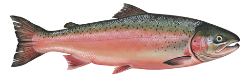
| Season / Restrictions | Bag Limit | Minimum Size | Maximum Size |
|---|---|---|---|
| May 1 – September 15 Rivers, brooks and streams ⚠ | 5 | 10cm | N/A |
| Exceptions | |||
| January 1 – December 31 Rivers, brooks and streams within 100 m of the Route 430 bridge, locally known as Miners Bridge | Closed to angling | ||
| January 1 – December 31 Fly Fishing in rivers, brooks and streams from a point 200 m above the South Branch of the Northwest Miramichi River, downstream to the Red Bank/Sunny Corner highway bridge | Fly fishing only | ||
| January 1 – December 31 Rivers, brooks and streams from a point 200 m above the South Branch of the Northwest Miramichi River upstream to its source, including all tributaries | Closed to angling | ||
| July 1 – December 31 Rivers, brooks and streams at the mouth of Sutherland Brook and including a portion of the said brook. This specific area consists of a portion of the Northwest Miramichi River inside a line drawn from (1) 46.94136, -65.81815 to (2) 46.94003, -65.81606; then to (3) 46.93857, -65.81808 to (4) 46.93850, -65.82057; to (5) 46.93867, -65.82082; and then to (6) 46.93979, -65.82049 (North American Datum 1983) | Closed after June 30 | ||
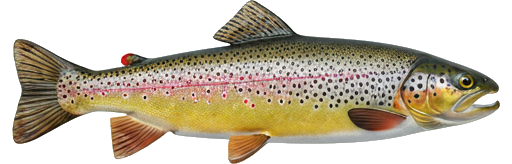
| Season / Restrictions | Bag Limit | Minimum Size | Maximum Size |
|---|---|---|---|
| May 1 – September 15 Rivers, brooks and streams ⚠ | 5 | 15cm | N/A |
| Exceptions | |||
| January 1 – December 31 Rivers, brooks and streams within 100 m of the Route 430 bridge, locally known as Miners Bridge | Closed to angling | ||
| January 1 – December 31 Fly Fishing in rivers, brooks and streams from a point 200 m above the South Branch of the Northwest Miramichi River, downstream to the Red Bank/Sunny Corner highway bridge | Fly fishing only | ||
| January 1 – December 31 Rivers, brooks and streams from a point 200 m above the South Branch of the Northwest Miramichi River upstream to its source, including all tributaries | Closed to angling | ||
| July 1 – December 31 Rivers, brooks and streams at the mouth of Sutherland Brook and including a portion of the said brook. This specific area consists of a portion of the Northwest Miramichi River inside a line drawn from (1) 46.94136, -65.81815 to (2) 46.94003, -65.81606; then to (3) 46.93857, -65.81808 to (4) 46.93850, -65.82057; to (5) 46.93867, -65.82082; and then to (6) 46.93979, -65.82049 (North American Datum 1983) | Closed after June 30 | ||
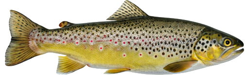
| Season / Restrictions | Bag Limit | Minimum Size | Maximum Size |
|---|---|---|---|
| January 1 – December 31 Non-tidal waters | 10 | 10cm | 100cm |
| January 1 – December 30 Tidal waters | 10 | 10cm | 100cm |
| Exceptions | |||
| January 1 – December 31 Rivers, brooks and streams within 100 m of the Route 430 bridge, locally known as Miners Bridge | Closed to angling | ||
| January 1 – December 31 Fly Fishing in rivers, brooks and streams from a point 200 m above the South Branch of the Northwest Miramichi River, downstream to the Red Bank/Sunny Corner highway bridge | Fly fishing only | ||
| January 1 – December 31 Rivers, brooks and streams from a point 200 m above the South Branch of the Northwest Miramichi River upstream to its source, including all tributaries | Closed to angling | ||
| July 1 – December 31 Rivers, brooks and streams at the mouth of Sutherland Brook and including a portion of the said brook. This specific area consists of a portion of the Northwest Miramichi River inside a line drawn from (1) 46.94136, -65.81815 to (2) 46.94003, -65.81606; then to (3) 46.93857, -65.81808 to (4) 46.93850, -65.82057; to (5) 46.93867, -65.82082; and then to (6) 46.93979, -65.82049 (North American Datum 1983) | Closed after June 30 | ||
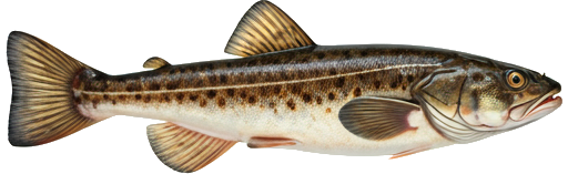
| Season / Restrictions | Bag Limit | Minimum Size | Maximum Size |
|---|---|---|---|
| May 1 – September 15 Rivers, brooks and streams ⚠ | 5 | 15cm | N/A |
| Exceptions | |||
| January 1 – December 31 Rivers, brooks and streams within 100 m of the Route 430 bridge, locally known as Miners Bridge | Closed to angling | ||
| January 1 – December 31 Fly Fishing in rivers, brooks and streams from a point 200 m above the South Branch of the Northwest Miramichi River, downstream to the Red Bank/Sunny Corner highway bridge | Fly fishing only | ||
| January 1 – December 31 Rivers, brooks and streams from a point 200 m above the South Branch of the Northwest Miramichi River upstream to its source, including all tributaries | Closed to angling | ||
| July 1 – December 31 Rivers, brooks and streams at the mouth of Sutherland Brook and including a portion of the said brook. This specific area consists of a portion of the Northwest Miramichi River inside a line drawn from (1) 46.94136, -65.81815 to (2) 46.94003, -65.81606; then to (3) 46.93857, -65.81808 to (4) 46.93850, -65.82057; to (5) 46.93867, -65.82082; and then to (6) 46.93979, -65.82049 (North American Datum 1983) | Closed after June 30 | ||
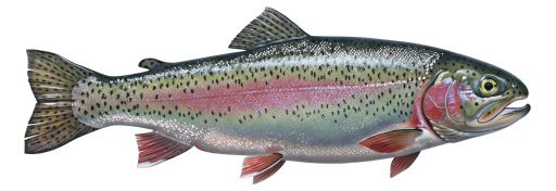
| Season / Restrictions | Bag Limit | Minimum Size | Maximum Size |
|---|---|---|---|
| January 1 – December 31 Non-tidal waters | 5 | N/A | N/A |
| January 1 – December 31 Tidal waters | 5 | N/A | N/A |
| Exceptions | |||
| January 1 – December 31 Rivers, brooks and streams within 100 m of the Route 430 bridge, locally known as Miners Bridge | Closed to angling | ||
| January 1 – December 31 Fly Fishing in rivers, brooks and streams from a point 200 m above the South Branch of the Northwest Miramichi River, downstream to the Red Bank/Sunny Corner highway bridge | Fly fishing only | ||
| January 1 – December 31 Rivers, brooks and streams from a point 200 m above the South Branch of the Northwest Miramichi River upstream to its source, including all tributaries | Closed to angling | ||
| July 1 – December 31 Rivers, brooks and streams at the mouth of Sutherland Brook and including a portion of the said brook. This specific area consists of a portion of the Northwest Miramichi River inside a line drawn from (1) 46.94136, -65.81815 to (2) 46.94003, -65.81606; then to (3) 46.93857, -65.81808 to (4) 46.93850, -65.82057; to (5) 46.93867, -65.82082; and then to (6) 46.93979, -65.82049 (North American Datum 1983) | Closed after June 30 | ||
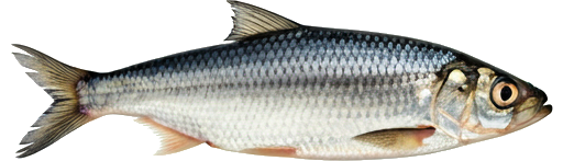
| Season / Restrictions | Bag Limit | Minimum Size | Maximum Size |
|---|---|---|---|
| April 15 – May 15 Fly Fishing in rivers, brooks and streams ⚠ | 0 ⚠ 5 | N/A | N/A |
| Exceptions | |||
| January 1 – December 31 Rivers, brooks and streams within 100 m of the Route 430 bridge, locally known as Miners Bridge | Closed to angling | ||
| January 1 – December 31 Fly Fishing in rivers, brooks and streams from a point 200 m above the South Branch of the Northwest Miramichi River, downstream to the Red Bank/Sunny Corner highway bridge | Fly fishing only | ||
| January 1 – December 31 Rivers, brooks and streams from a point 200 m above the South Branch of the Northwest Miramichi River upstream to its source, including all tributaries | Closed to angling | ||
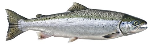
| Season / Restrictions | Bag Limit | Minimum Size | Maximum Size |
|---|---|---|---|
| January 1 – December 31 Non-tidal waters | 25 | 10cm | 50cm |
| January 1 – December 30 Tidal waters | 25 | 10cm | 50cm |
| Exceptions | |||
| January 1 – December 31 Rivers, brooks and streams within 100 m of the Route 430 bridge, locally known as Miners Bridge | Closed to angling | ||
| January 1 – December 31 Fly Fishing in rivers, brooks and streams from a point 200 m above the South Branch of the Northwest Miramichi River, downstream to the Red Bank/Sunny Corner highway bridge | Fly fishing only | ||
| January 1 – December 31 Rivers, brooks and streams from a point 200 m above the South Branch of the Northwest Miramichi River upstream to its source, including all tributaries | Closed to angling | ||
| July 1 – December 31 Rivers, brooks and streams at the mouth of Sutherland Brook and including a portion of the said brook. This specific area consists of a portion of the Northwest Miramichi River inside a line drawn from (1) 46.94136, -65.81815 to (2) 46.94003, -65.81606; then to (3) 46.93857, -65.81808 to (4) 46.93850, -65.82057; to (5) 46.93867, -65.82082; and then to (6) 46.93979, -65.82049 (North American Datum 1983) | Closed after June 30 | ||
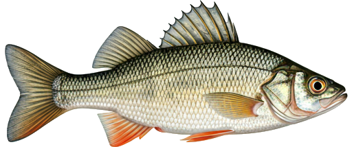
| Season / Restrictions | Bag Limit | Minimum Size | Maximum Size |
|---|---|---|---|
| January 1 – September 15 Non-tidal waters | 8 | 10cm | 70cm |
| January 1 – September 15 Tidal waters | 8 | 10cm | 70cm |
| Exceptions | |||
| January 1 – December 31 Rivers, brooks and streams within 100 m of the Route 430 bridge, locally known as Miners Bridge | Closed to angling | ||
| January 1 – December 31 Fly Fishing in rivers, brooks and streams from a point 200 m above the South Branch of the Northwest Miramichi River, downstream to the Red Bank/Sunny Corner highway bridge | Fly fishing only | ||
| January 1 – December 31 Rivers, brooks and streams from a point 200 m above the South Branch of the Northwest Miramichi River upstream to its source, including all tributaries | Closed to angling | ||
| July 1 – December 31 Rivers, brooks and streams at the mouth of Sutherland Brook and including a portion of the said brook. This specific area consists of a portion of the Northwest Miramichi River inside a line drawn from (1) 46.94136, -65.81815 to (2) 46.94003, -65.81606; then to (3) 46.93857, -65.81808 to (4) 46.93850, -65.82057; to (5) 46.93867, -65.82082; and then to (6) 46.93979, -65.82049 (North American Datum 1983) | Closed after June 30 | ||
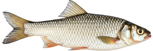
| Season / Restrictions | Bag Limit | Minimum Size | Maximum Size |
|---|---|---|---|
| January 1 – December 31 Non-tidal waters | 100 | 10cm | 50cm |
| January 1 – December 30 Tidal waters | 100 | 10cm | 50cm |
| Exceptions | |||
| January 1 – December 31 Rivers, brooks and streams within 100 m of the Route 430 bridge, locally known as Miners Bridge | Closed to angling | ||
| January 1 – December 31 Fly Fishing in rivers, brooks and streams from a point 200 m above the South Branch of the Northwest Miramichi River, downstream to the Red Bank/Sunny Corner highway bridge | Fly fishing only | ||
| January 1 – December 31 Rivers, brooks and streams from a point 200 m above the South Branch of the Northwest Miramichi River upstream to its source, including all tributaries | Closed to angling | ||
| July 1 – December 31 Rivers, brooks and streams at the mouth of Sutherland Brook and including a portion of the said brook. This specific area consists of a portion of the Northwest Miramichi River inside a line drawn from (1) 46.94136, -65.81815 to (2) 46.94003, -65.81606; then to (3) 46.93857, -65.81808 to (4) 46.93850, -65.82057; to (5) 46.93867, -65.82082; and then to (6) 46.93979, -65.82049 (North American Datum 1983) | Closed after June 30 | ||